
Bridgeport Reservoir December 10th

Virginia Lake December 10th (old but clean sections-good for the Alpenglow)

Tioga Lake December 11th (next 4 pics) - old thick but glassy between crack lines


Prosser Reservoir


More Pictures December 23rd:
https://picasaweb.google.com/111461517128275850244/20111223IceSkateProsserReservoir?authuser=0&feat=directlink
Conditions at Tenaya Lake


..Gotta do another road tripThis a beautiful lake in Yosemite accessible by Highway 120. This is quintessential treat for anyone that loves skating on natural ice. Tenaya was marginal in early December, but consistent drops into the teens thickened the ice. This inspired skaters from all over to come enjoy it.


Some videos on YouTube inspired me to head back up, since being able to drive to Tenaya and have good ice this time of year are both rare. It looked like the night/morning of 12/27-28 was going to be the last of the cold period AND it was holiday season. Gotta try.....
We got to Tenaya and skated at sunrise (of course the ~East/West orientation keeps the lake in shade for quite a while this time of year-which is good). The ice was a foot thick with the thinnest spots in isolated areas around 4-5" thick and only a few melt spots near the outlet and a spot in the middle that was sheeted but thin. The ~north side of the lake had the ice buckled up onto the shore form expansion; the expansion actually having moved boulders. The south side which appeared to remain in the shade, was clear black ice. Although cracked, there were stretches of very glassy smooth ice that provided incredible glides with a view of the lake bottom. Being able to see through ice while skating is a treat. It feels as though I'm simultaneously observing a transcendence of dimensions and physical phases while in motion.
We arrived and skated in solitude for a couple hours. Soon skates and travellers showed up. By the time we left around 1:30pm, there were well over a hundred people enjoying the ice. Temperatures in warm spots were close to 60°F and people began sunbathing. The ice surface began to form a skim layer that was getting close to the high spots by the time we left. The south side in the shade remained good quality with no apparent melt. If no snow falls over the next couple weeks, the melted skim layer could form a natural Zamboni effect. With the slab of ice that is already there, clear nights with lows in the low 20s or teens should keep the ice in good shape, with the skim layer even improving the surface.
Temperature trend shows warming on the afternoon of the 28th which formed skim layer:

Tenaya Lake Morning of December 28th


Worth the Choreography.....
It is mid-January and still no snow. Temps have been cold enough that morning skates are probably still good although ice is getting old and blemished with surface aberations even with some skim layers forming.
Link to more pictures: https://picasaweb.google.com/111461517128275850244/20111228TenayaLakeIceSkate?authuser=0&feat=directlink
Below is a link to a video someone posted online in mid-December. Made me want to head back up for one more skate.
Synoptic Weather Pattern in Early December Setting up a persistent pattern


Recent strong NE winds may have blown the small amount of snow off any previous ice if the snow did not fall wet or cause snow ice. The following plot is from the CDEC Water resources site: http://cdec.water.ca.gov/cgi-progs/queryF?TNY

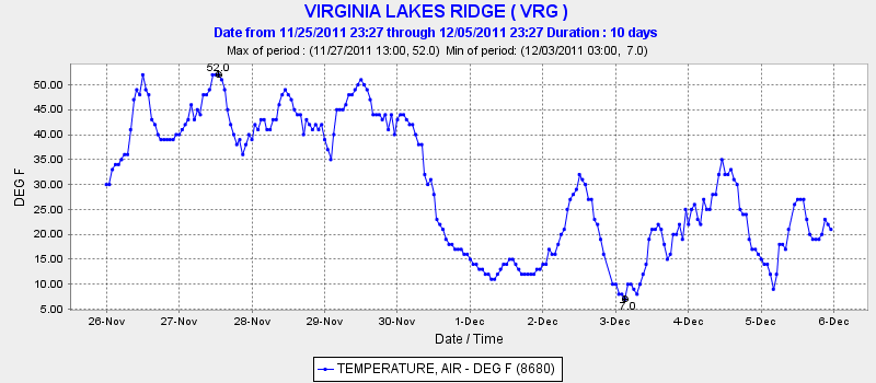
Sources of Temperature Data for Estimating Ice Formation
Other locations for California can be found here: http://cdec.water.ca.gov/cgi-progs/mapper
These data go back some time so that that trends over the entire fall can be looked at.
Another good source of surface data to see temperature trends is the Mesowest site which provides data and plots of temperature for the past 7 days for various regions:
Temperatures provided by surface stations are representative and can actually vary significantly from microscale conditions at the water body(s) of interest. Overall trends with regional weather stations should be considered along with observations. It is obviously easiest to watch the ice form and make physical measurements of thickness along with observing temperatures; however, this is often not practical. With remote sensing data available on the internet, the likelihood of ice formation can determined adequately enough to pursue further investigation.Early December 2011 Temperature Forecasts
Forecast for the week is single digits and teens for lows in the Eastern Sierra cold air basins. Some inversions indicated at upper levels moderating temperatures, but generally colder higher up. Daytime highs in the 30s and 40s. A week worth of single digit lows and only 8 hours of daylight for ramping


No comments:
Post a Comment